By Tim Schürmann
Marble [1] is an open source virtual desktop globe and atlas with different map themes and multiple projections, including flat and Mercator, besides the globe.
Marble is part of the KDE Edutainment project, which develops a variety of educational programs for the KDE desktop. If you use KDE Edutainment, you might already have the globe installed on your disk, but, just to make sure, check the start menu where Marble typically slots into the Edutainment program group.
If you can't find it, take a quick look at your package manager: Depending on your distribution, the virtual globe will be either in the marble package or bundled with some other educational programs in the kdeedu archive.
Marble itself now fully relies on KDE4. For users with other desktops, such as Gnome, or the older KDE 3.5, the developers have a special variant of the program on offer. As the name Marble-Qt suggests, you simply need the Qt4 libraries. On the downside, this version lacks a couple of interesting features, such as the ability to download maps automatically via GHNS. If you prefer to have the full feature set, you have no alternative but to opt for a parallel KDE4 installation. If you are interested in finding out what kind of features the full version of Marble offers, why not experiment with the Live CD [2] (see the "Marble in a Box" information box).
| Marble in a Box |
|
The Marble in a Box Live CD allows users to test the digital globe without installing gigabytes of data. The openSUSE-based disc is perfect for demonstrating the program to your Windows friends or for classroom use, although the Live version might lag slightly behind the most recent offering. The Live CD comes in two variants: a lean version that weighs in at just 350MB and a variant with the Blue Marble satellite images. This makes the ISO file twice as big, but it does remove the need to download the files off the Internet. In this way, you can avoid network bottlenecks in a classroom with multiple PCs. |
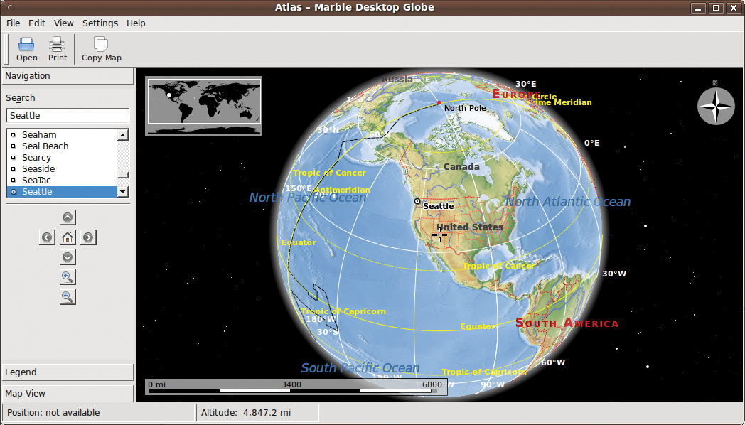
When first launched, Marble displays a globe like that in Figure 1. The crosshairs in the middle of the image, which you might have some difficulty seeing, point to the US Pacific Northwest.
To rotate the artificial globe about its axes, just drag your mouse. If this approach makes you dizzy, simply point the mouse at one of the edges of the window. When you click, Marble then moves the map in the corresponding direction, as shown by a white arrow.
To navigate, use the bar in the left pane of the window under the Navigation tab. The arrow buttons let you rotate the virtual earth in different directions. The button with the home icon takes you back to the original view. To set a new home, right-click your preferred location on the map and select Set home location.
The zoom function lets you zoom into or out of a view, although you can do this more quickly with your mouse wheel. Depending on the resolution of your map, higher zoom levels might not give you as clear a view as you would like.
To navigate to a specific location, you can either select the location from the list or type its name in the Search box. Marble will automatically rotate the virtual earth to the correct position and select the city.
Clicking the selected position displays a drop-down menu that shows not only the exact coordinates but also, if you click on the name of the town, a variety of other information, if available, such as the population. The Wikipedia tab takes you to the matching entry.
As an additional treat, Marble also accesses the Flickr photo service on the web. Once you have enabled Flickr by selecting View | Online Services | Photos, you will see photos that other users have taken in the regions displayed, although they might be just cute snapshots of puppies or flowers. Clicking View | Online Services | Wikipedia lets Marble query the online encyclopedia. If you choose this option, Marble marks locations that have a Wikipedia entry with a W. Clicking a photo or a W pops up a menu with your Flickr or Wikipedia choices.
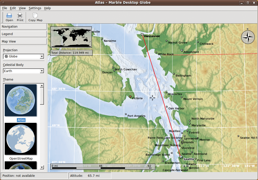
To measure the distance between two points, right-click the starting point, select Add Measure Point and repeat the procedure for the endpoint. Marble draws a red line and tells you the Total Distance in the top left corner (Figure 2). If needed, you can add more Measure Points to calculate, for example, the distance from Seattle to Vancouver and then on to Calgary. Right-clicking again lets you remove any measure points you no longer need.
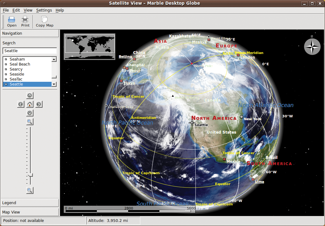
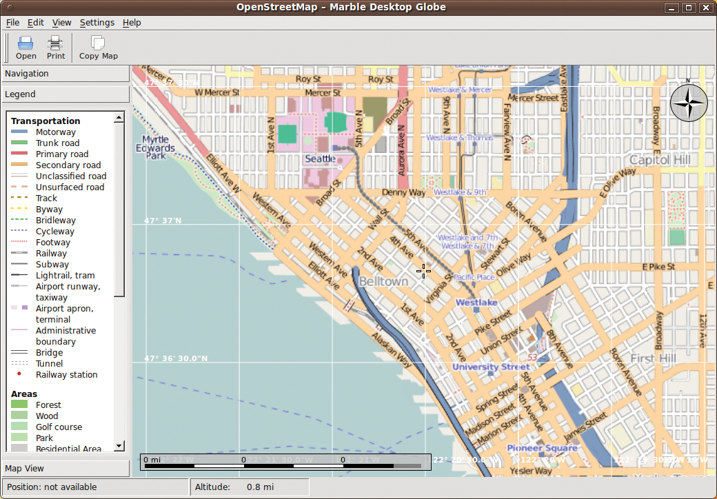
The sidebar on the left side of the window has a Map View tab. Under Theme, you can switch to a different map type. Besides classical topographic maps, like those you are probably familiar with from your school days, Marble offers a satellite view (based on NASA's Blue Marble Next Generation pictures; Figure 3), the earth by night, temperature and precipitation maps at two times of the year, two ocean depth maps, a road map (Figure 4), and more.
The Legend tab tells you what all the colorful lines, dots, and symbols on the map mean. At the bottom of this list, you can disable the coordinate grid, which can become quite annoying, especially at high resolutions. View | Info Boxes lets you hide or display more controls on the map, such as the compass rose at the top right or the overview map, which has been switched off in Figure 4.
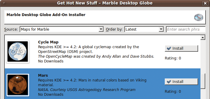
The map material you have installed defines what maps you can use and at what degree of precision. By default, Marble installs about 15MB of data, but you can install more maps via File | Download Maps (Figure 5). This lets you install virtual views of other planets, such as Mars or Venus, on your disk. Marble only accesses free sources, including the OpenStreetMap project [3] and servers with NASA satellite photos. Additionally, you can add your own maps in the KML format.
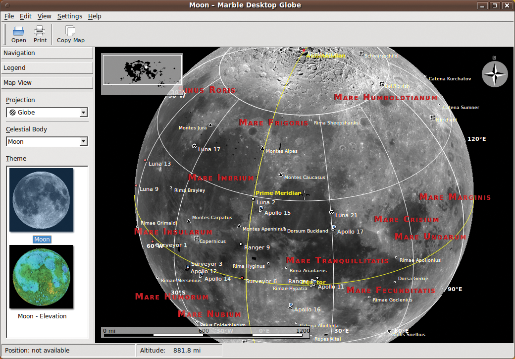
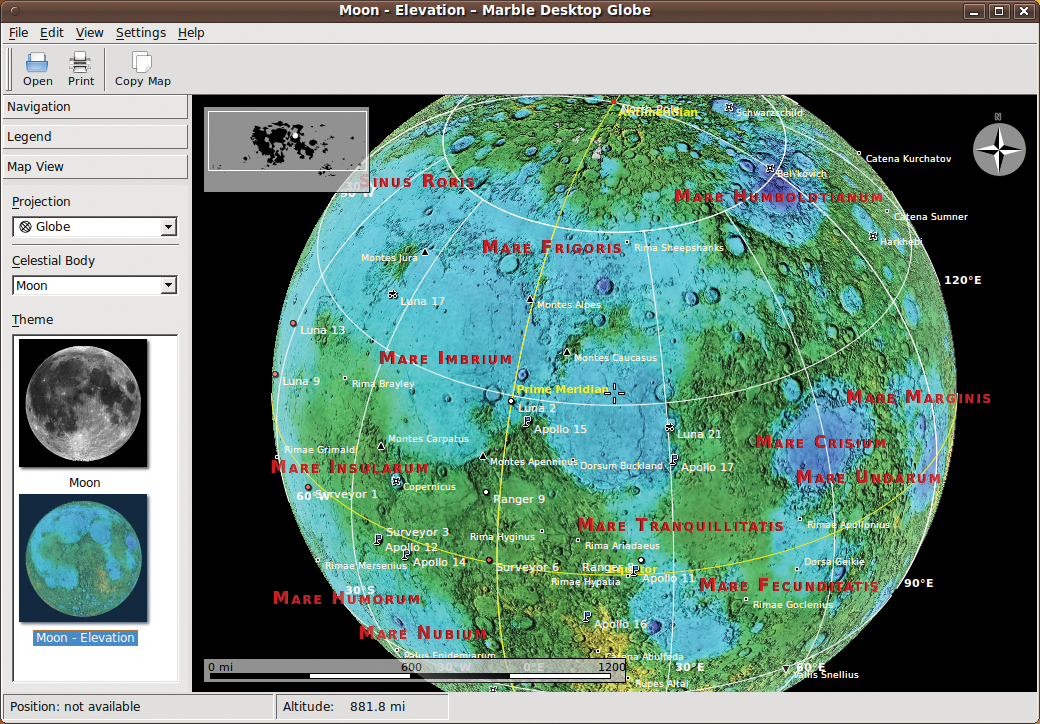
To switch to a view of the Moon's surface or satellite images of Venus, use the Celestial Body drop-down list in the Map View tab.The Moon has two views: the typical gray-scale shaded relief map (Figure 6) and a color-coded elevation map (Figure 7).
The Projection item lets you specify how Marble should display the data onscreen for the planet in question. Besides the Globe and Flat Map options, you can choose a Mercator projection.
In some views, Marble downloads the current cloud cover from the web and superimposes it on the map. This only works for higher zoom levels. If the cloud cover is bothering you, you can disable it by selecting View | Clouds.
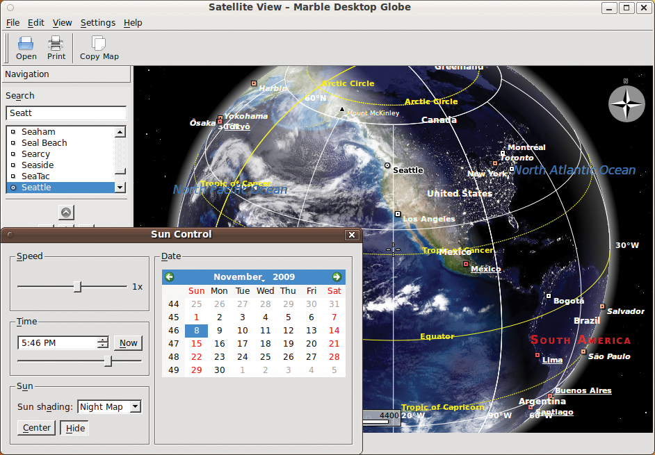
If you are interested in finding out where in the world it is currently nighttime, use View | Sun Control, which lets you darken one half of the earth (Figure 8). To move the night/day border (terminator), use the Time sliding control. If the Sun shading drop-down option is set to Night Map, the Earth at Night map, which shows cities as lit up at night, is used for the dark side.
When you find an image that you like, you can select File | Export Map to save it as an image file; however, note that some restrictions exist as far as how you can process the results or publish them on your homepage. Although much of the map data are in the public domain, the OpenStreetMap project, for example, requires you to quote the source if you publish their street data. For more information, refer to the Marble FAQ [4].
Messing around with Marble is fun and educational. Even though it does not need 3D graphics hardware acceleration, the globe reacts quickly to user input. Because the map material is stored on the local disk in most cases, you typically do not need to open an Internet connection.
Maps by OpenStreetMap are an exception to this rule, which is one reason the program is not (yet) capable of replacing a GPS navigation system. Marble still lags well behind its competitor Google Earth in features, although it is catching up at an impressive pace.
The future of Marble looks really interesting, and scripting functions in particular give developers a variety of options in addition to the standards (see the "Marble for Programmers" box).
| Marble for Programmers |
|
Marble can be integrated quickly and easily into your own applications. The globe is available in the form of a library, QWidget, and KDE4 KPart. Thanks to the D-Bus interface, you can even use a shell script to manipulate elements. For example, the following command line gives you a larger zoom factor in an open window: $ qdbus org.kde.marble-$(pidof marble) /MarbleWidget org.kde. MarbleWidget.zoomIn For more information and examples of support for programming languages, refer to the technical documentation in the KDE TechBase wiki [5]. |
| INFO |
|
[1] KDE homepage: http://edu.kde.org/marble
[2] Marble download: http://edu.kde.org/marble/download.php [3] OpenStreetMap: http://www.openstreetmap.org/ [4] Marble FAQ: http://techbase.kde.org/Projects/Marble/FAQ [5] Marble technical documentation: http://techbase.kde.org/Projects/Marble |